Skip to content

Washburn Fire

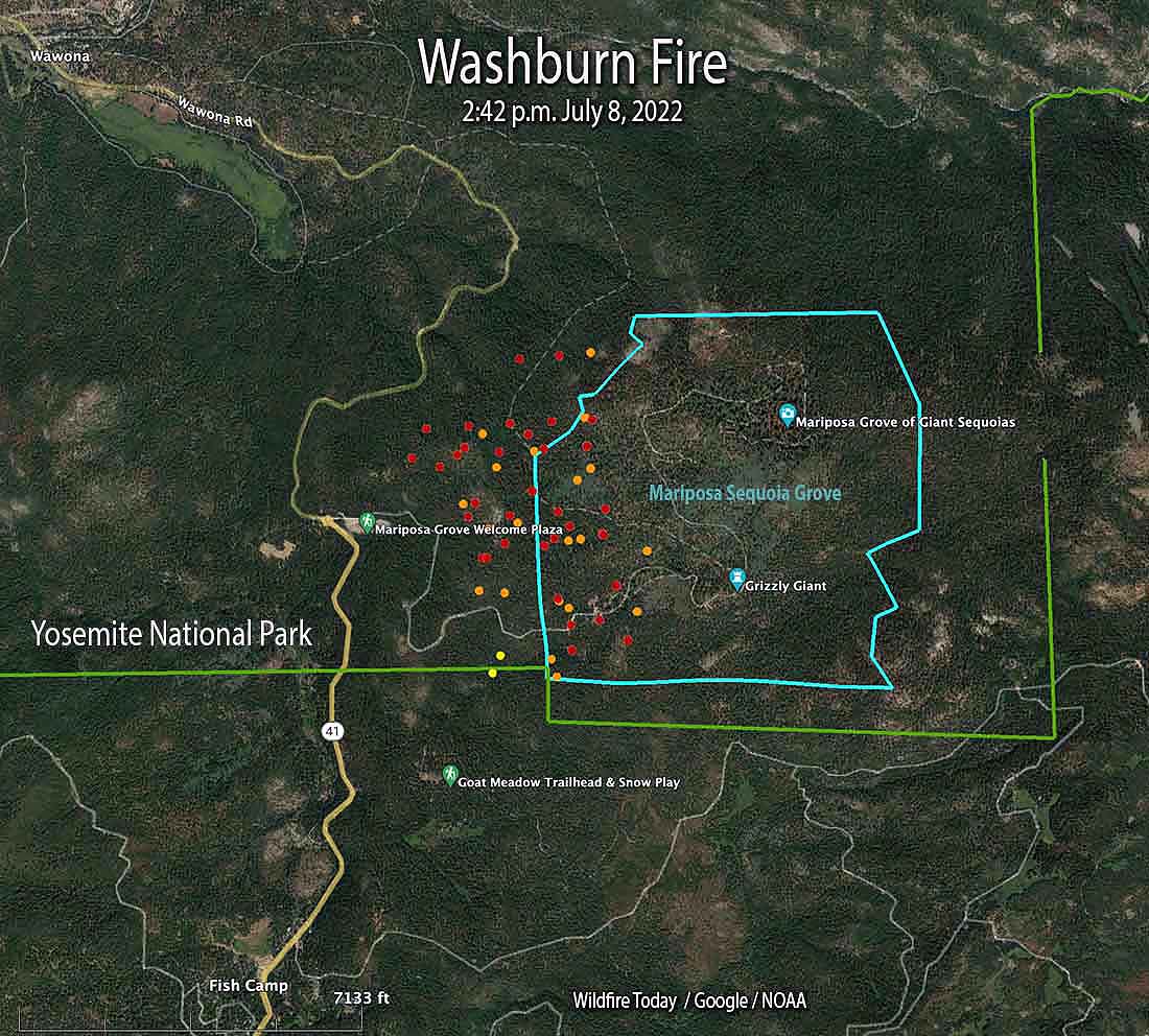
It’s fire season again, and we’ve got one near us . . . not threatening us, but part of the Washburn fire is burning old growth trees in the Mariposa Grove.

The fire started Thursday afternoon and as of 4 pm Friday its at 466 acres.

Washburn Fire map. The dots represent heat detected by a satellite as late as 2:42 p.m. July 8, 2022. The red dots are the most current.

We really became aware when we saw the water helicopters flying overhead . . .

The left helicopter is getting water, the right helicopter is taking water to the fire


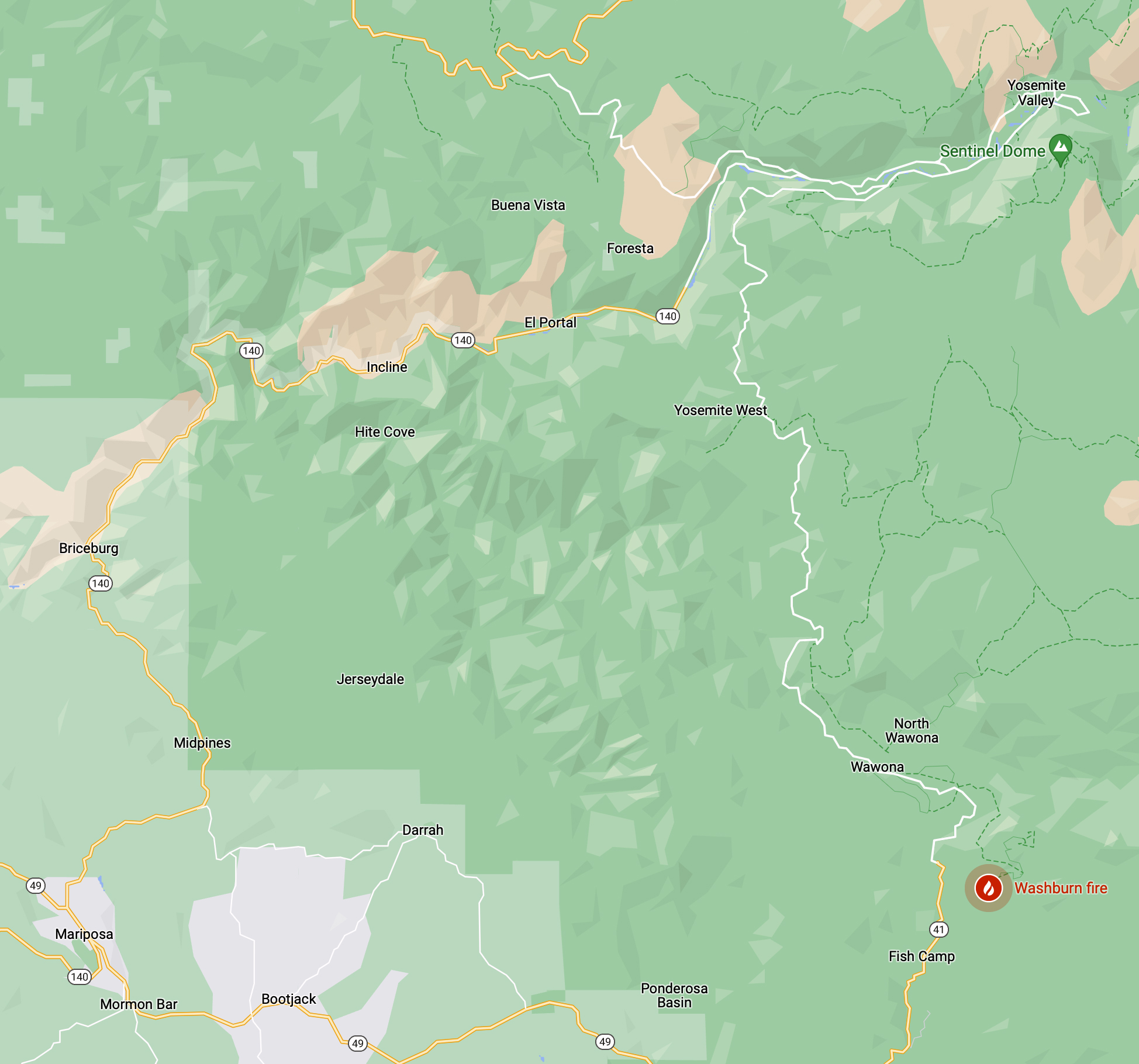
Here’s a map that shows the Washburn fire is relation to the Mariposa Grove, Yosemite Park, and Mariposa where we are.

Mariposa is about 18 miles away from Fish Camp (as the crow flies)
Ground View of the Washburn Fire
One Comment Post a comment
  1. Sister Mary #

    Keeping an eye out for the Washburn fire. Damn!
    Sister Mary

    July 9, 2022

Leave a Reply

Fill in your details below or click an icon to log in:

WordPress.com Logo

You are commenting using your WordPress.com account. Log Out /  Change )

Facebook photo

You are commenting using your Facebook account. Log Out /  Change )

Connecting to %s

This site uses Akismet to reduce spam. Learn how your comment data is processed.

%d bloggers like this: