Skip to content

Archive for

Movie Flats

Just off Whitney Portal Road (Click To Enlarge)

Just off Whitney Portal Road (Click To Enlarge)

On Thursday afternoon we drove down to Lone Pine (about an hour away) to check out the “Movie Flats” in the Alabama Hills.

On the drive there we passed Manzanar which was a Japanese internment camp during World War II. It’s now a national historic site which we’re definitely going to visit during our stay in Bishop.

Movie Flats Jeep Trip

Movie Flats Jeep Trip

At the start of the Movie Flats Road there’s a plaque that says:

“Since 1920, hundreds of movies and TV episodes, including Gunga Din, How the West Was Won, Khyber Rifles, Bengal Lancers and High Sierra, along with The Lone Ranger and Bonanza, with such stars as Tom Mix, Hopalong Cassidy, Roy Rogers, Gary Cooper, Gene Autrey, Glenn Ford, Humphrey Bogart, and John Wayne, have been filmed in these rugged Alabama Hills with their majestic Sierra Nevada background.

Plaque dedicated by Roy Rogers, whose first starring feature was filmed here in 1938.”

What a great place to film! Mountains, foothills, desert, valley, weird rocks, . . .

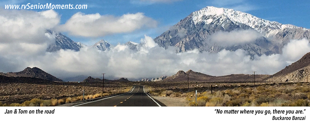
To get to Movie Flats we drove down Whitney Portal Road which leads to (wait for it) Whitney Portal (elevation 7,800 feet) the jumping off point for Mount Whitney (14,500 feet) climbers. Whitney Portal is on our To See list.

Here are some photos from the trip:

This slideshow requires JavaScript.

This is a movie of us driving to the valley floor . . .

If You Like Mules . . .

Then you’ll love Mule Days.

This Saturday Jan & I drove into Bishop at about 9am to get a spot for the 10am Mule Days parade.

This slideshow requires JavaScript.

Not much of a crowd at first so we just wandered around, but when the parade started, people came out of the woodwork.

We stayed for about an hour and took these videos (narrated by the parade master of ceremonies) . . .

Weird Weather

On Thursday afternoon, we took a short drive up Highway 168 into the mountains.

Into the Snow

Snow Day

We weren’t sure what to expect because lately the weather has been cold and wet.

Sure enough, as we climbed higher the temperature kept dropping and at about 8000 feet . . .

We skedaddled back to Bishop because the road we were on had some pretty steep stretches, and we didn’t want to play slip ‘n slide.

The People You Meet

Moon's Journeys

Moon’s Journeys (click to enlarge)

While working in the campground office this afternoon, Australian Ron Moon walked into the office for an overnight campsite.

I figured he was Australian because of the Australian flag on his 4WD vehicle and his, well, rather thick accent.

So I started up a conversation with him telling Ron how much I admired Australia’s national anthem, “Waltzing Matilda”. But he told me that wasn’t the national anthem — even though a lot of Australians (including himself) wished it was.

Ron said we was a world traveler, a writer for an Australian 4WD magazine, who apparently paid for a lot of his travel adventures. Here is his website: Ron & Viv Moon.

Then he showed me his world journey map attached to the side of his vehicle (see above). Zow! He told me that his 2008 trek through Mongolia and Kazakhstan was great, but in Russia they wanted to arrest him as a spy.

Ron’s last two years have been in North America.

This year he’ll travel to Mexico, Texas, Tennessee, and then Nova Scotia.

The people you meet.


THE VIEWS YOU SEE

We had a couple of days of rain in Bishop which means snow in the higher elevations.

Remember that trip we took to Mammoth Lakes a fews days ago? There was hardly any snow when we went. Now there’s over a foot and they’re extending the skiing season.

When we look out our RV’s front window, we now see the snow-capped White Mountains:

View Out Our Front Window

View Out Our Front Window (click to enlarge)

When we exit Vonn’s, our local grocery store, we see the Sierra Nevadas:

Mammoth Lakes

Mammoth Lakes Loop

Mammoth Lakes Loop


We took a day trip to Mammoth Lakes which is about 40 miles up the road from Bishop.

The town is located at 8,000 feet (about 4000 feet up from Bishop) which caused some minor ear popping. However, Mammoth Lakes is also a lot cooler — about 20 degrees — than Bishop, and I didn’t account for that when I wore shorts. There was still snow on some roads.

Anyway, it was stellar! Our drive followed the Sierras and several mountains in the range are still snow covered. About two-thirds of the way to Mammoth Lakes, the road (Highway 395) turns West, gains more elevation, and if you look South, you can see the long valley between the ranges.

We took Highway 203 into Mammoth Lakes and stopped at the visitor’s center. We left with good info and maps.

We’ve seen lakes before, but not in a mountainous environment. Beautiful.

Horseshoe Lake and Lake Mary were the only two lakes we saw up close and both lakes were low (see the map above).

Horseshoe Lake was the most interesting — it’s a Carbon Dioxide Hazard Area . . . see the photos below . . .

This slideshow requires JavaScript.