Skip to content

Jeepin’ Buttermilk Road – Part 2

Click on photo to enlarge

Click on photo to enlarge

The temps have been in the mid-80s lately, so what better time for another Jeep trip . . .

Bar_720x10pixels
Forgot the map — Buttermilk Road Map (77MB)

Bar_720x10pixels


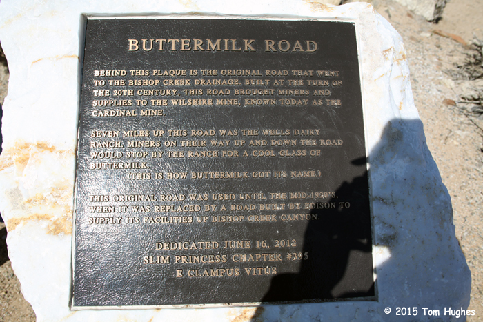
We decided to return to Buttermilk Road which we discovered in early April. We wanted to go back because the terrain looked really interesting, and we wanted to explore.

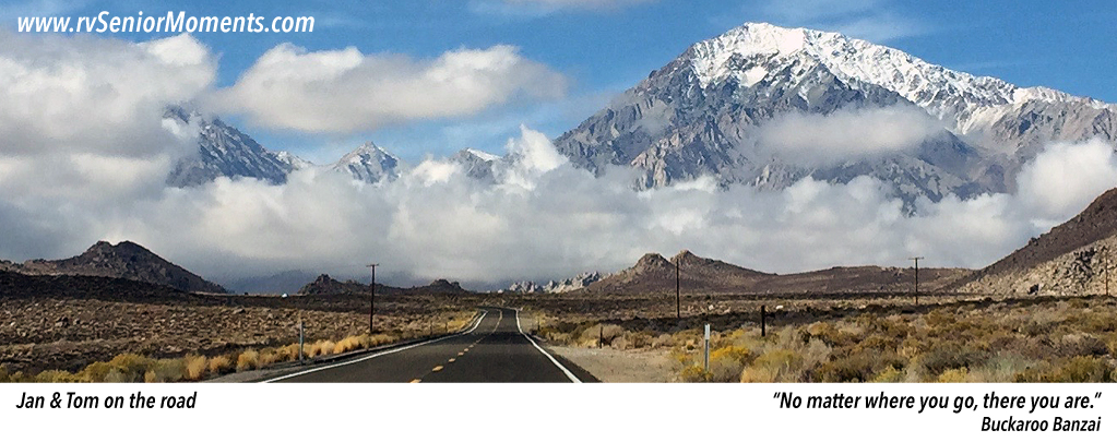
We started the trip at about 11:30am. Since it only took us a half hour to get to the point where we stopped last time, we kept driving, and driving, and driving, . . . you get the picture.

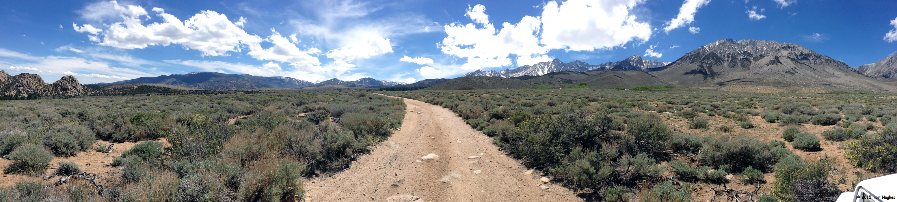
The road was pretty rocky in spots, but the views were fantastic. On the other hand, we didn’t know where the road went, and we relied on our Garmin 760LMT GPS to show us the way.

We hoped it ended up at the highway, but for all we knew we would have to turn around on return the same way we came. As we drove on and on, that became less and less desirable, even though the BLM (Bureau of Land Management) rated our route as “easy”.

So we crossed a valley floor, drove through a mountain forrest, and climbed up another mountain. By that time it was about 3pm and we started worrying if we’d get back before the dogs peed in the RV.

And then it happened! We met an ATVer coming towards us. He stopped and we asked for directions which he gave — the best part was that we were on the right road and going the right direction. Yahoo!

We made it back home at about 3:30pm. The dogs were fine.

Here are some photos and videos from the trip . . .

This slideshow requires JavaScript.


Jeepin’ Up Silver Canyon

Silver Canyon Trip

On Wednesday afternoon we thought we’d try a shortcut to the Ancient Bristlecone Pine Forest. This is the place we visited on April 5th.

Though it looks like a short drive on a map, it’s a long climb up — 6000 feet. But as they say, the first 3000 feet is easy, and that’s as far as we got. After an hour of slow driving, we turned back because the last 3000 feet was steep with a lot of switchbacks.

Silver Canyon Terrain

We’ll try it again when we have more time.

Some photos and a video from the trip . . .

This slideshow requires JavaScript.


Web Cam (Literally)

On Sunday, we had dinner with Herb & Bev, two of our friends we met at Crazy Horse Campground. Since Herb has been coming to the Bishop, CA area for a number of years, during dinner he gave us some suggestions on what to see in the area. As a joke, I asked Herb if he could clean the spider webs from one of our park model’s security cameras when he returned to Crazy Horse this week. (Though it was interesting to watch the spider build his web night after night, the spider was making it harder and harder to see anything.)

Thanks Herb!

Ancient Bristlecone Pine Forest

Sierra View @ Vista Point

Sierra View @ Vista Point (Click to Enlarge)

On Saturday afternoon we drove the Jeep to the Ancient Bristlecone Pine Forest which is at about 11,100 feet. Since we started at 4,100 feet in Bishop,CA, that’s 7,000 feet of driving up. We could tell.

Besides popping our ears every now and then, there were those precipitous drop offs along the road (see one of the videos below).

Bristlecone01

The Trip (Click to Enlarge)

It was a 38-mile, 2-hour drive from Bishop to Bristlecone.

But more than half the trip was climbing those 7,000 feet, and it was SLOW driving.

Near the top we started seeing patches of snow. Nothing much, but in former years we would not have been able to drive there because snow would have blocked the roads.

Welcome to the Great California Drought.

When we arrived at the Bristlecone Forest Ranger Station, we took a short hike down the Methuselah Walk Trail and took some photos and videos of the area. The pine smell was incredibly strong in the clean mountain air.

This slideshow requires JavaScript.

Jeepin’ Buttermilk Road outside of Bishop, CA

Buttermilk00 We took a Jeep trip into the foothills of the West Sierra Mountains on Thursday morning.

The views were fantastic!

We saw a number of rock climbers, backpackers, and campers. We met a man from Michigan in a 1971 4WD pickup with over 200,000 miles who was camping in the back country. By the way, the man said he was a survivor of four heart bypass surgeries. A nice guy.

After driving higher and higher for an hour, we had lunch at the base of Mount Tom.

Incredible country!

Some photos from our trip . . .

This slideshow requires JavaScript.