Skip to content

Posts from the ‘Uncategorized’ Category

The People You Meet

Moon's Journeys

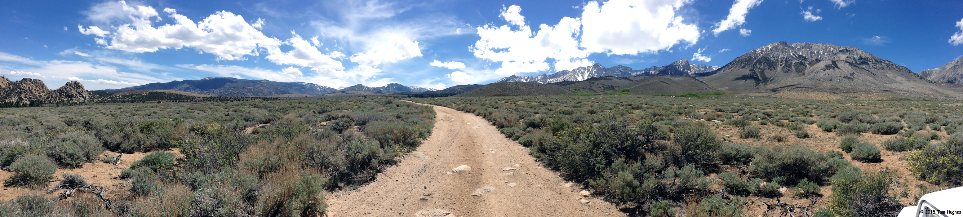
Moon’s Journeys (click to enlarge)

While working in the campground office this afternoon, Australian Ron Moon walked into the office for an overnight campsite.

I figured he was Australian because of the Australian flag on his 4WD vehicle and his, well, rather thick accent.

So I started up a conversation with him telling Ron how much I admired Australia’s national anthem, “Waltzing Matilda”. But he told me that wasn’t the national anthem — even though a lot of Australians (including himself) wished it was.

Ron said we was a world traveler, a writer for an Australian 4WD magazine, who apparently paid for a lot of his travel adventures. Here is his website: Ron & Viv Moon.

Then he showed me his world journey map attached to the side of his vehicle (see above). Zow! He told me that his 2008 trek through Mongolia and Kazakhstan was great, but in Russia they wanted to arrest him as a spy.

Ron’s last two years have been in North America.

This year he’ll travel to Mexico, Texas, Tennessee, and then Nova Scotia.

The people you meet.


THE VIEWS YOU SEE

We had a couple of days of rain in Bishop which means snow in the higher elevations.

Remember that trip we took to Mammoth Lakes a fews days ago? There was hardly any snow when we went. Now there’s over a foot and they’re extending the skiing season.

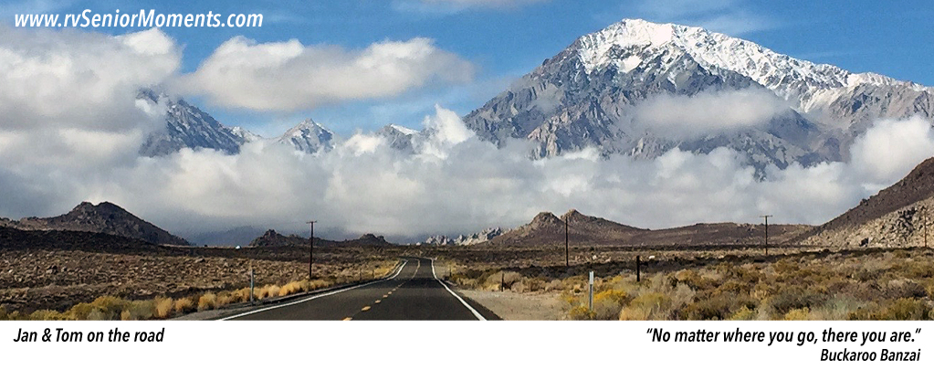
When we look out our RV’s front window, we now see the snow-capped White Mountains:

View Out Our Front Window

View Out Our Front Window (click to enlarge)

When we exit Vonn’s, our local grocery store, we see the Sierra Nevadas:

Mammoth Lakes

Mammoth Lakes Loop

Mammoth Lakes Loop


We took a day trip to Mammoth Lakes which is about 40 miles up the road from Bishop.

The town is located at 8,000 feet (about 4000 feet up from Bishop) which caused some minor ear popping. However, Mammoth Lakes is also a lot cooler — about 20 degrees — than Bishop, and I didn’t account for that when I wore shorts. There was still snow on some roads.

Anyway, it was stellar! Our drive followed the Sierras and several mountains in the range are still snow covered. About two-thirds of the way to Mammoth Lakes, the road (Highway 395) turns West, gains more elevation, and if you look South, you can see the long valley between the ranges.

We took Highway 203 into Mammoth Lakes and stopped at the visitor’s center. We left with good info and maps.

We’ve seen lakes before, but not in a mountainous environment. Beautiful.

Horseshoe Lake and Lake Mary were the only two lakes we saw up close and both lakes were low (see the map above).

Horseshoe Lake was the most interesting — it’s a Carbon Dioxide Hazard Area . . . see the photos below . . .

This slideshow requires JavaScript.


Tacos, Enchiladas, Fried Ice Cream, and Mariachi Music

Dinner at Astorgas on Cinco de Mayo where we forgot just how loud unamplified music can be.

A great night . . .

Ducks

There are two duck families that hang around our campground pond. They go up and down the stream that feeds the pond, grazing and eating as they go.

However, since the stream goes under the campground road, the ducks have to cross the road to get to . . . (you know the rest).

And it’s a busy road.

So as I was watching the ducks one day . . . 5 chicks starting crossing, but there were 2 chicks left, so mom went back . . .

I stopped filming because there was a Ford F250 at my back, and I gestured to him to stop.

The ducks (mom + all 7 chicks) made it across ok, and I filmed them downstream . . .

Jeepin’ Buttermilk Road – Part 2

Click on photo to enlarge

Click on photo to enlarge

The temps have been in the mid-80s lately, so what better time for another Jeep trip . . .

Bar_720x10pixels
Forgot the map — Buttermilk Road Map (77MB)

Bar_720x10pixels


We decided to return to Buttermilk Road which we discovered in early April. We wanted to go back because the terrain looked really interesting, and we wanted to explore.

We started the trip at about 11:30am. Since it only took us a half hour to get to the point where we stopped last time, we kept driving, and driving, and driving, . . . you get the picture.

The road was pretty rocky in spots, but the views were fantastic. On the other hand, we didn’t know where the road went, and we relied on our Garmin 760LMT GPS to show us the way.

We hoped it ended up at the highway, but for all we knew we would have to turn around on return the same way we came. As we drove on and on, that became less and less desirable, even though the BLM (Bureau of Land Management) rated our route as “easy”.

So we crossed a valley floor, drove through a mountain forrest, and climbed up another mountain. By that time it was about 3pm and we started worrying if we’d get back before the dogs peed in the RV.

And then it happened! We met an ATVer coming towards us. He stopped and we asked for directions which he gave — the best part was that we were on the right road and going the right direction. Yahoo!

We made it back home at about 3:30pm. The dogs were fine.

Here are some photos and videos from the trip . . .

This slideshow requires JavaScript.